


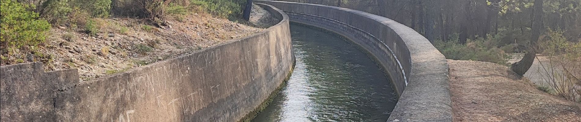
Le Tholonet Lac Zola

kephas
User
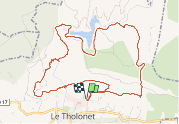

Length
8.1 km

Max alt
313 m

Uphill gradient
306 m
Km-Effort
12.2 km

Min alt
200 m

Downhill gradient
305 m
Boucle
Yes
Creation date :
2023-10-03 09:09:20.026
Updated on :
2023-10-06 17:55:07.654
2h46
Difficulty : Difficult

FREE GPS app for hiking
 SityTrail
IGN / Geographical institutes
SityTrail Plus
The world is yours!
About
Trail Walking of 8.1 km to be discovered at Provence-Alpes-Côte d'Azur, Bouches-du-Rhône, Le Tholonet. This trail is proposed by kephas.
Photos


Positioning
Country:
France
Region :
Provence-Alpes-Côte d'Azur
Department/Province :
Bouches-du-Rhône
Municipality :
Le Tholonet
Location:
Unknown
Start:(Dec)
Start:(UTM)
703204 ; 4822058 (31T) N.
Comments